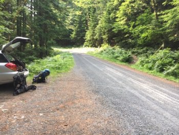
We started at the Trailhead for Burley Mountain off Forest Road 28 because the Covel Creek Trailhead had warnings about bridges out and telling people to use that trailhead for the Angel Falls Loop, apparently a somewhat popular loop. There is barely parking for 2-3 cars as most people choose to drive the 18 miles on FR 77. It is also not easy to see the trail - we ended up driving right by it = even though GPS said around there = so below I have included a photo of what it looked like. The shorter way to Burley is being repaired and could be open soon. We wanted to backpack it as part of our quest is taking our time with each lookout we visit and getting exercise. We knew there was unlikely to be water based on our research so we loaded up with five liters each at the falls that were at one mile and 500 gain in on the trail. About halfway to said falls was a small cave on the left.
The next 2.25 miles of this were STEEP. It gains 2500 to where it meets with the road. You will go through a section where salal is mostly covering the trail making the use of poles nigh impossible. After that .5 mile or so, you will come to the section with quite a bit of blowdown slowing your progress = at least three of them you must crawl under. We were happy to see the road and know that the second half was mostly gentler than what we had just done. We rested at the intersection and had lunch. It took us one hour and forty minutes to do that section.
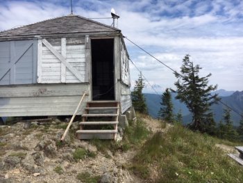
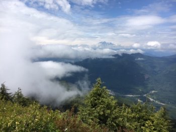
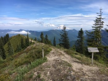
Shortly after joining with the road, I saw a small water source that could well be dry later in the summer as it was just trickling. It was around 3.5 miles in. The road was mostly in great shape. There was one rocky, kind of mucky, narrow section just before the intersection with the final mile to the lookout. This final part was more open and in good shape for about a third of a mile. It was after that where we found deep dips and narrow, steep road that only a high clearance vehicle or motorcycle could make. Even though it was cloudy on one side, views were obviously finally appearing. We were tired by the last steep section to the lookout. At that final corner was the reward of seeing the lookout and Rainier coming out of the clouds.
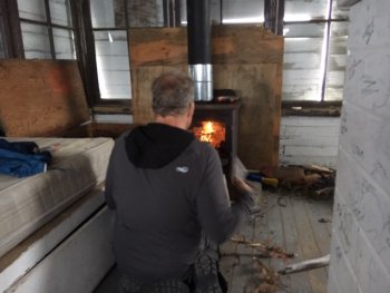
We were lucky that after all that work at 3 pm on Friday, July 5 we were able to claim the lookout However, there was a steady stream of company including after it totally socked in and even as it became dark. The last people came up at 9:30 and made a racket for over an hour. If you want solitude at this lookout, come up on a weekday and maybe you will have it to yourselves. Still, it was cold after it socked in so we were glad for the protection of the lookout and its lovely fire. There is a solidly built potty near the lookout. We shared the lookout with some mice. We hung our food, but they still wanted to join us. I hadn't slept in a lookout for a few years so This was fun. It was Dave's first time to sleep in one. We headed back out around 8:30 a.m. When it was clear, views of Adams, Hood, Rainier, and St Helen's.
Dave's GPS Track